At night, on a clear night, from the east-west coastal road* that runs along the north shore of Frenchman's Bay, the lights of Bar Harbor are visible across the water. They line a dark shore with mountain behind a great ocean liner floating upon the waters. If not clear, if fog or rain obscure, a keen sense of disappointment can settle in on the traveler.
*[US Coastal 1]The Island and The Peninsula
In the heart of Down East Maine are The Island and The Peninsula. Mount Desert Island and the Schoodic Peninsula are seperated from each other by Frenchman's Bay. The trip by boat from Winter Harbor on the Schoodic Peninsula to fabled Bar Harbor on Mount Desert Island can be quite brief by boat - several miles, several minutes. We have frequently sailed it in under an hour. A fast lobster boat can do it in under 10 minutes.
The main road link between between Mount Desert Island (MDI) and The Peninsula is US Coastal 1 which, for most of its link between them, runs along the north shore of Frenchman's Bay. At the top of the page you can see a photograph that we took from Coastal 1. It shows The Island with Bar Harbor approximately in the center.
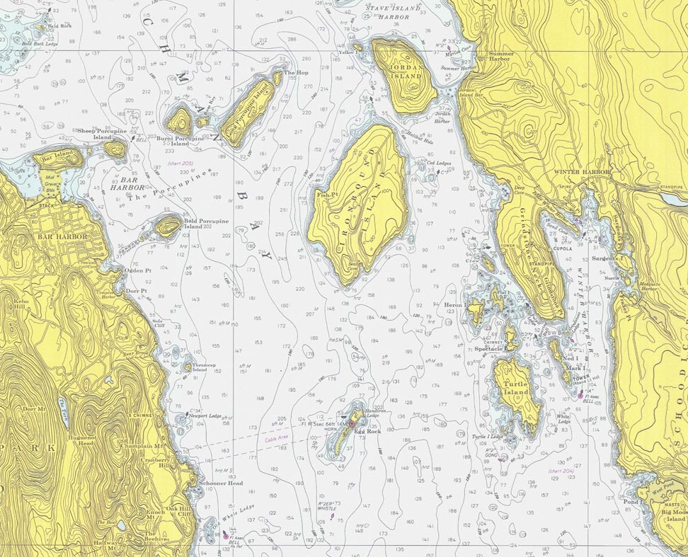
Below is a fragment of C&GS (Coast and Geodetic Survey) chart #1202 which shows the waters around The Island and The Peninsula. These are some of the finest sailing grounds in the world:
Islands Mountains and Bays
Hurray Hurray Hurray.
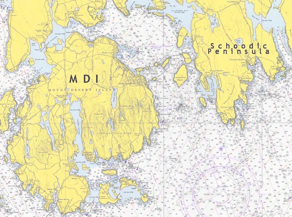
Below is a fragment of chart 306 (now 13318) that shows the region between Winter Harbor and Bar Harbor.